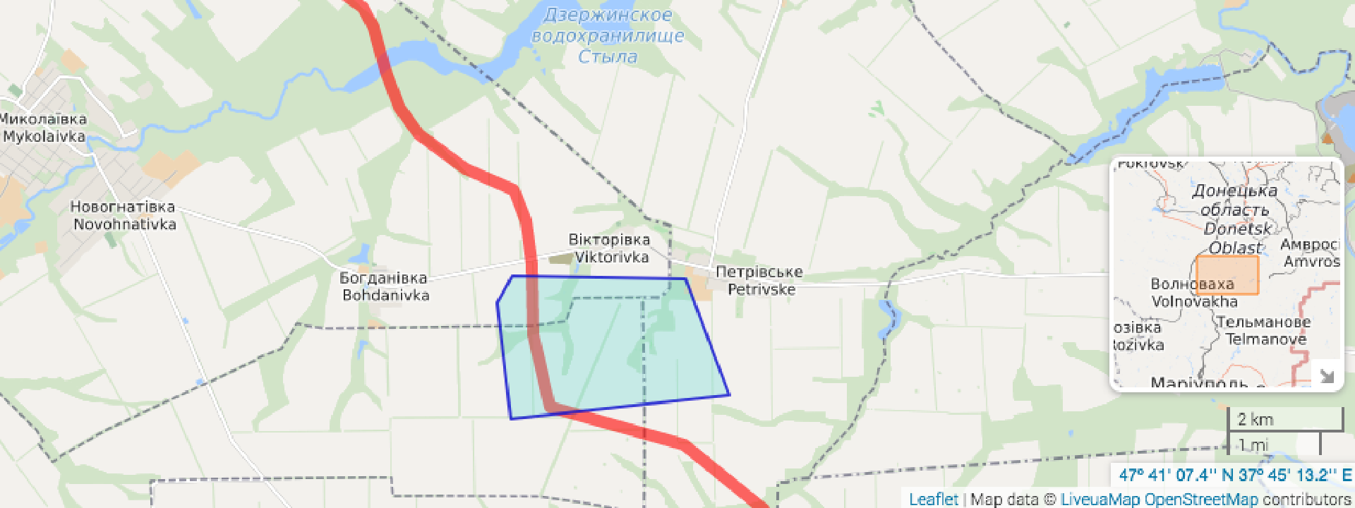
Military Engagement at the Petrivske Disengagement Area
Military positions in and around civilian areas in easternUkraine
Military Engagement at the Petrivske Disengagement Area
Military positions in and around civilian areas in eastern Ukraine

On November 10, the Organization for Security and Co-operation in Europe’s Special Monitoring Mission (OSCE SMM) to Ukraine used surveillance drones to observe extensive military positions and trenches, mortar firing positions, heavy machine guns, and infantry fighting vehicles (IFV) assessed to belong to the Ukrainian Armed Forces (UAF) inside the Petrivske disengagement area in the Donetsk Oblast, an area that all sides agreed to disengage along with areas in Zolote and Stanytsia Luhanska on September 21, 2016.
https://twitter.com/OSCE_SMM/status/931489618092089344
Disengagement is intended to include the “withdrawal of armed forces/formations and hardware from their current positions” to “to alleviate the situation for civilians who continue to pay the price for the ceasefire violations.” However, disengagement has yet to fully maintain ceasefire and withdrawal in the pilot areas.
https://twitter.com/OSCE_SMM/status/931489804847591424
Additionally, the OSCE SMM re-observed over 200 TM-62 anti-tank mines just north of the Petrivske disengagement area. The United Nations Office for the Coordination of Humanitarian Affairs (OCHA) reported mine and unexploded ordanance (UXO) contamination is on the rise, quickly making Ukraine “one of the world’s most mine contaminated countries” and leaving at least 600,000 civilians in dangerous “highly mine-contaminated areas.” Over 66 percent of civilian casualties recorded in October were caused by mines, explosive remnants of war (ERW), or booby-traps.
Despite the unmanned aerial vehicle (UAV), or drone, flights being conducted in the presence of UAF officers under the Joint Centre for Control and Co-orgination (JCCC) and advance notice of the flights, two of the three flights were interrupted due to small arms fire assessed to be aimed at the UAV. The OSCE SMM’s UAV imagery revealed the location of two UAF BMP-1 infantry fighting vehicles (IFV), and detailed the UAF position in the area.
What’s in the area around the UAV imagery?
Using Google Earth’s historical imagery feature, @DFRLab observed a large trench developing some time between June and August 2016, just before the sides officially agreed to disengage on September 21, 2016.

While the most recent imagery available is from September 2016, the position matches the OSCE SMM surveillance drone imagery from November 10.


Petrivske, Donetsk Oblast
The town of Petrivske (outside the boundaries of the disengagement area) itself is riddled with trenches and military positions embedded throughout houses and residential areas likely manned by separatists of the so-called Donetsk People’s Republic (DNR). The @DFRLab has previously reported on harassment of OSCE SMM monitors from the Russian-led forces of the so-called DNR.


Military Positions Around the Petrivske Disengagement Area
The areas around around the Petrivkse disengagement area on both sides of the contact line are riddled with trenches and military positions. Below, @DFRLab highlighted some of the more substantive positions in the area.


Conclusion
Unfortunately, the agreed upon Petrivske disengagement area does not appear to be near fulfilling requirements, as the OSCE SMM continues to regularly observe ceasefire violations, military positions, and various weapons. @DFRLab previously reported on military positions and trenches throughout the Donbas, especially concerning positions close to civilian areas.
We will continue to monitor report as there are further developments.
Follow the latest Minsk II violations via the @DFRLab’s #MinskMonitor.
Also, follow @DFRLab on Twitter for more in-depth analysis from our #DigitalSherlocks.