#MinskMonitor: Ukrainian Advance Near Volnovakha
Ukrainian Armed Forces continue consolidation of positions near Petrivske Disengagement Area
#MinskMonitor: Ukrainian Advance Near Volnovakha
Ukrainian Armed Forces continue consolidation of positions near Petrivske Disengagement Area

Last week, the Ukrainian Armed Forces seized control of a settlement near Volnovakha, south of Donetsk. This recent maneuver was reported by the “Joint Forces Operation” (formerly Anti-Terrorist Operation) and the Ukrainian NGO “Come Back Alive,” which often provides photographs and videos from the frontline. This development is notable due to the fact that the area seized by Ukrainian forces borders the Petrivske Disengagement Area, which was established following a bilateral agreement between Ukrainian and Russian-led separatist forces in 2016.
This maneuver continues a trend that @DFRLab reported on throughout 2018: Ukraine’s forces have made a concerted effort to consolidate control in the disputed settlements near strategic hotspots along the conflict’s frontline, both in the Donetsk and Luhansk oblasts.
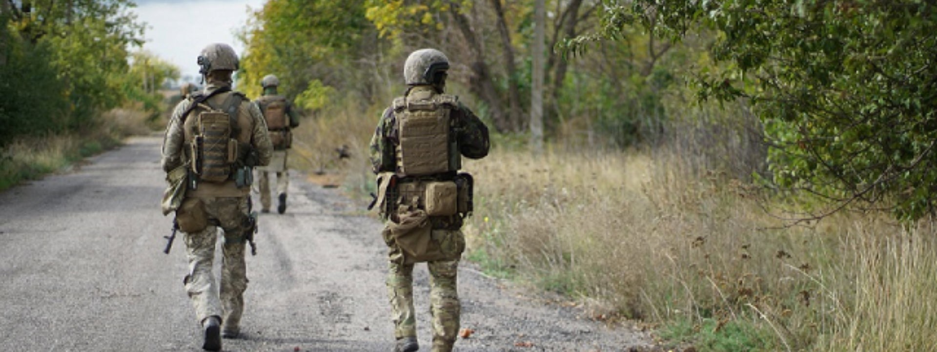
Photoshoot Near Volnovakha
The “Come Back Alive” NGO reported on the Ukrainian maneuver by sharing nine high-resolution photographs that looked like they could have come out of a magazine spread, showing Ukrainian troops in an unnamed settlement near Volnovakha. Few of these images reveal unique geographic details, making geolocation difficult.


The NGO did not provide specifics on where the photographs were taken, but noted that the area was heavily mined, the settlement was used by Russian-led separatist forces to carry out artillery attacks on Ukrainian positions, and that 80 villagers used to live in the settlement before the war. Ukrainian troops — according to the NGO — advanced 1,200 meters from their previous area of control.
Drone Footage From the JFO
The Joint Forces Operation, however, provided plenty of content. Geolocation of the village was made possible from a video shared on October 10.
[facebook url=”https://www.facebook.com/pressjfo.news/videos/1533920603374083/” /]
The next day, popular Ukrainian blogger “Loogunda” provided a geolocation of the drone footage at the beginning of the JFO’s clip, pointing to the settlement of Viktorivka, located about 20 kilometers east of Volnovakha. By comparing the drone footage with Google Earth satellite imagery of Viktorivka, we can confirm this geolocation by roughly recreating the perspective.

With the on-the-ground footage from the JFO and “Come Back Alive” combined with the geolocation of the drone footage, @DFRLab can conclude with confidence that Ukrainian forces did indeed take control of the village of Viktorivka. While this village seems relatively inconsequential because it is over a dozen kilometers from any noteworthy towns and not along any major transportation routes, it is located right next to the Petrivske Disengagement Area.
Petrivske Disengagement Area
In November of last year, the @DFRLab examined the “extensive military positions and trenches” from the Ukrainian Armed Forces in the Petrivske Disengagement Area. Back in September 2016, both Russian-led separatist forces and Ukraine agreed on the “disengagement of forces and hardware”, including the “withdrawal of armed forces/formations and hardware from their current positions”, in a “2km wide and 2km deep” area from Petrivske. The OSCE SMM explicitly chose this area for disengagement due to the large number of military fortifications and positions near Petrivske and Viktorivka, which border the southern edges of both settlements.

The OSCE Special Monitoring Mission (SMM) to Ukraine has recently noted Ukrainian activity in this disengagement area, leading up to last week’s advance into Viktorivka. Last month, for example, the monitoring mission observed military hardware and forces in fortified positions along the designated disengagement area.
On 10 September, inside the Petrivske disengagement area, an SMM long-range unmanned aerial vehicle (UAV) spotted two Ukrainian Armed Forces soldiers, about 500m south of the area’s northern edge and about 2km of its western edge, near previously seen positions of the Ukrainian Armed Forces (see SMM Daily Report 21 May 2018), as well as a probable infantry fighting vehicle (BMP-1) about 900m north of the area’s southern edge and 1.2km east of its western edge, assessed as belonging to the Ukrainian Armed Forces. (See also SMM Daily Report 11 September 2018.)
@DFRLab updated its map showing current trenches and military fortifications in the area to match the current situation. In the map below, red lines indicate entrenched positions, with the shaded red area roughly estimating the area of soft control from Russian-led separatists. The trench to the south of Viktorivka is squarely in the middle of the Petrivske Disengagement Area and trenches to the west and east of it are also inside the area defined by the OSCE SMM to Ukraine.

Conclusion
Much like Ukraine’s creeping advances near in the Luhansk oblast this year, there was no major military engagement in Ukraine’s seizure of control in Viktorivka; rather, Ukraine moved its troops into unoccupied areas mostly devoid of civilians or significant strategic value. While the OSCE SMM to Ukraine recently reported that they observed a “calm situation” in the area on Friday, October 12, the apparent maneuvers around and possibly into the Petrivske Disengagement Area is concerning and requires further monitoring.
Follow the latest Minsk II Violations via the @DFRLab’s #MinskMonitor.
Follow along for more in-depth analysis from our #DigitalSherlocks.