Hot Winter Weeks Near Donetsk
An open source survey and verification of the last two weeks of Minsk violations
Hot Winter Weeks Near Donetsk
Share this story
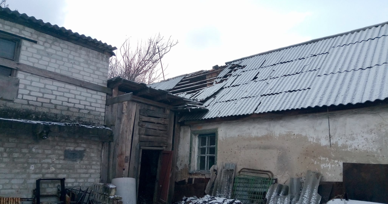
BANNER: Shelled roof at Shevchenko 10, Avdiivka. Source
Over the last two weeks, areas north of Donetsk saw a significant uptick in fighting, resulting in multiple casualties and thousands of observed explosions. In the daily reports from the OSCE Special Monitoring Mission (SMM) to Ukraine from November 25 to the current day, monitors counted the observable explosions and outgoing salvos north of Donetsk in areas such as Yasynuvata, the Donetsk Airport, Avdiivka, and the nearby “Promzone,” short for “industrial area” in Russian. Principal Deputy Chief Monitor of the OSCE SMM to Ukraine, Alexander Hug, last week said that “the last three weeks were some of the most violent we have registered ever.” What can digital forensics tell us about this escalation of fighting north of Donetsk and its human impact?
Avdiivka and the “Promzone”
For a large part of the Ukrainian conflict, the Ukrainian military and pro-Russian separatists have been deadlocked in the so-called “Promzone,” an industrial area southeast of Avdiivka. The Ukrainian military currently controls this area, but has been caught in a seemingly endless battle defending it, with both sides trading artillery and small arms fire on an almost nightly basis.
Throughout the last two weeks, the OSCE SMM to Ukraine observed hundreds of explosions from its monitoring positions focused on Avdiivka and the Promzone, with projectiles fired from both sides of the warring parties. A typical series of observations can be seen in the December 2 report, in which the OSCE SMM to Ukraine describes what they observed without assigning explicit blame to either side:
“During the night of 1–2 December, the SMM camera in government-controlled Avdiivka (17km north of Donetsk) recorded 43 undetermined projectiles in flight and 12 undetermined explosions all 3–6km east-south-east, beginning with ten undetermined projectiles in flight from east to west. Among the rest of the 33 undetermined projectiles the camera recorded 27 undetermined projectiles in flight west to east, and an additional six in flight from east to west. During the day on 2 December the SMM camera recorded six explosions and ten undetermined projectiles in flight, two from south to north, four from north-east to south, and four from north to south, all 3–6km east-south-east.”
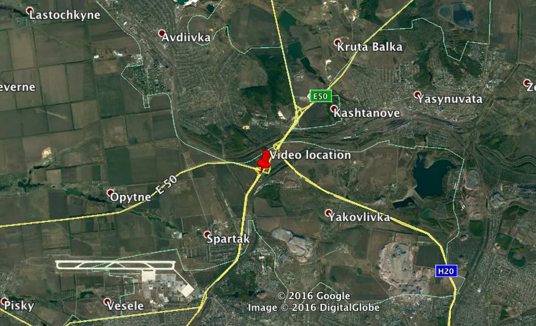
However, it is not terribly difficult to parse who is doing what, as we have a clear idea regarding the current front lines near the Promzone, thanks to maps released by military officials and crowdsourced efforts. In short, Ukraine controls area to the north and west of the Promzone, and separatists control area to the south and east.
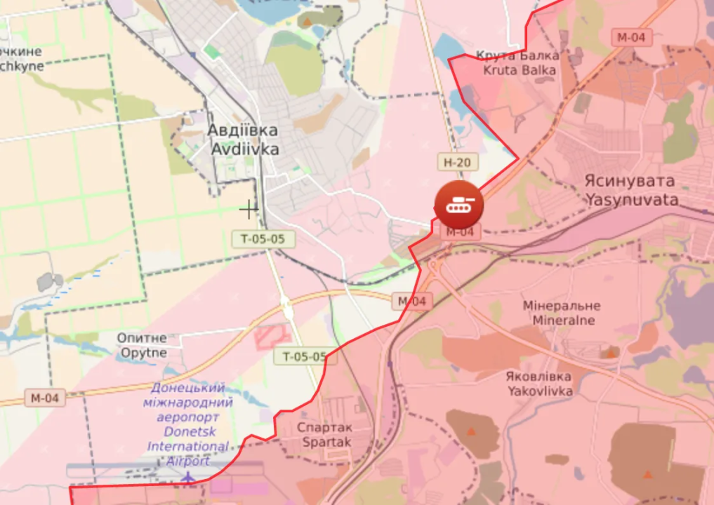
By referring to this map and comparing it with the SMM to Ukraine report, it appears that on the night of December 1–2, pro-Russian separatists launched a salvo of at least 10 undetermined munitions westwards towards government-held territory. Government forces retaliated with a heavier salvo of at least 27 shots eastwards, while the separatists fired at least six more times. Not all exchanges can be attributed this clearly, and many of the detonations recorded in the SMM to Ukraine’s reports cannot be located precisely, but on this one night, the pattern does appear relatively clear.
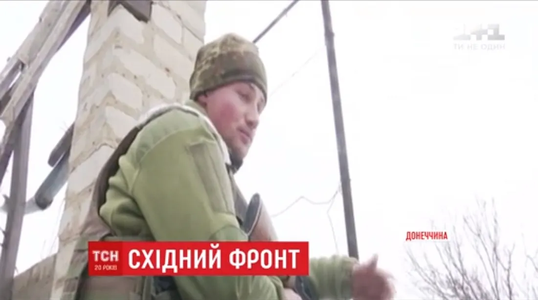
A news dispatch from a Ukrainian military camp near the Promzone from TSN shows us the current situation, with soldiers from both sides entrenched and trading fire throughout the day and night without making any notable territorial gains or losses.
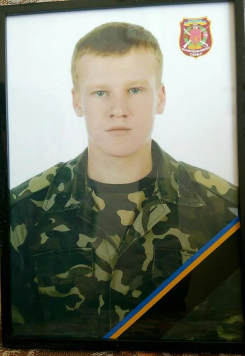
However, there is still a human cost to this stalemate. On November 29, a Twitter user sent out a message saying that 20 minutes ago, they found out that their friend, a Ukrainian soldier named Maks, died near Avdiivka.
This news was later reported on by Ukrainian media, confirming that a 22-year old soldier named Maksim Slomchinsky died from shrapnel wounds near Avdiivka on November 29.
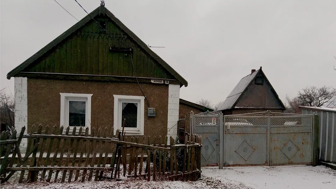
There was also harm to civilian lives and property near Avdiivka during these especially active two weeks. On November 30, the day after the soldier died, the roofs of three houses were damaged after early-morning shelling, resulting in a 49-year-old civilian being taken to the hospital with shrapnel wounds. The damaged houses were located at Shevchenko 10, Lermontova 79 and Kirova 53 in Avdiivka, with the injured man at the Shevchenko address.
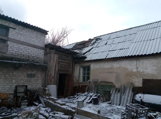
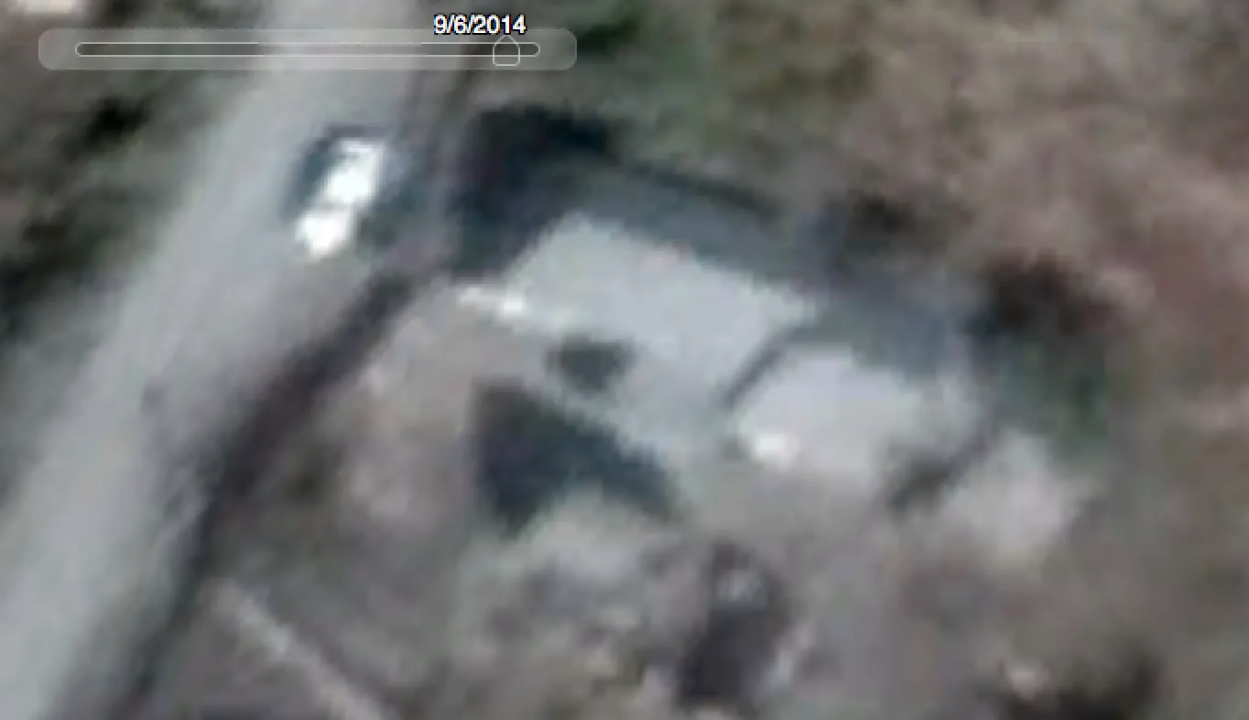
Per recent reports, the injured man survived and was being treated in a local hospital. We can confirm that this house was located at Shevchenko 10 both by the obvious address on the front of the house in one of the images posted online and in analyzing satellite imagery for the location.
Yasynuvata and Nearby Highways
Perhaps even more than the Promzone and Avdiivka, Yasynuvata has recently experienced a dramatic uptick in shelling and violence.
The OSCE SMM to Ukraine reports are corroborated by locals, who described hearing incoming and outgoing salvos on social media during the same period north of Donetsk.
ФБ 22.50 К Заперевальная с вечера слышно залпы в стороне Ясиноватой. Продолжаются до сих пор.
— Hochu dodomu v UA (@hochu_dodomu) November 26, 2016
Киевский: прошлую всю ночь бахали и сейчас бахают с северной стороны… #АТО #Донецк #Стоптеррор
— Alfa Nubovsky (@AlfaNubovsky) November 26, 2016
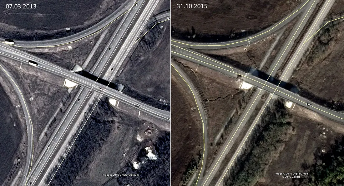
Heavy fighting continued in the area through the two weeks surveyed in this analysis. In the most publicized incident, on November 27, the head of the self-proclaimed Donetsk People’s Republic, Aleksandr Zakharchenko, and a Russian singer named Aleksandr Sklyar met with separatist soldiers under a bridge on the Yasynuvata highway. While at their fortified position under the bridge, they observed shelling nearby, but with no apparent injuries.
It is unclear which side was conducting the shelling, but OSCE SMM to Ukraine observations in the area reported artillery fire originating from territory controlled by both sides in the area near Yasynuvata and the highway leading to it. However, it is possible to verify the self-reported location (between Avdiivka and Yasynuvata) of the video showing the singer and separatist leader meeting with separatist soldiers, with the sound of shelling nearby.
Zakharchenko and Sklyar were positioned in a separatist fortification underneath an overpass located at 48.103474, 37.792112, on the M04 highway that leads into Yasynuvata and runs just east of the Avdiivka Promzone. Comparisons of the position from 2013 to the most recent imagery in 2015 shows how fortifications were added over time.
In the video shared by the pro-separatist news outlet News-Front, we see Zakharchenko and his passenger approach an overpass north of Donetsk:
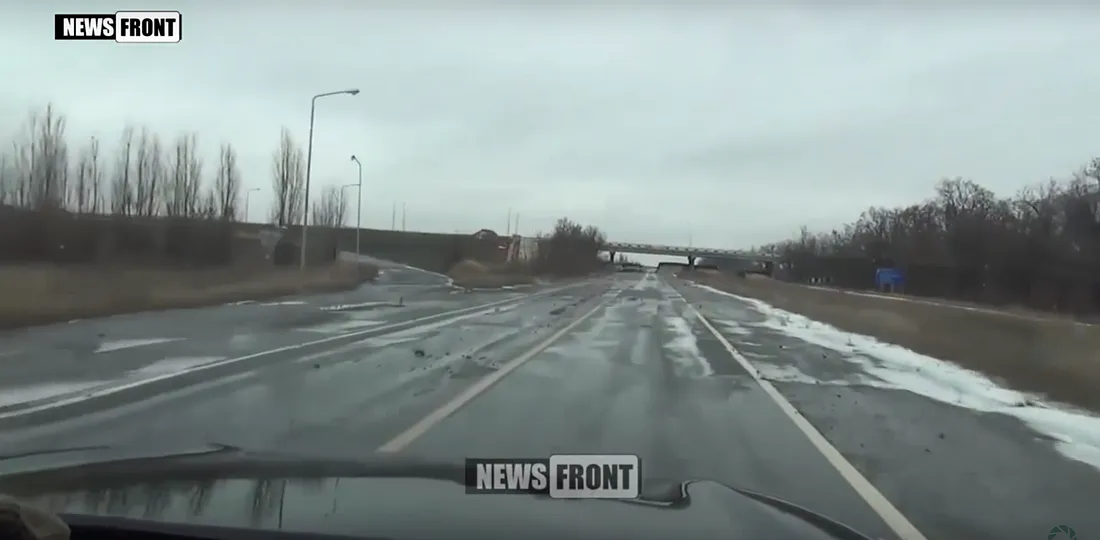
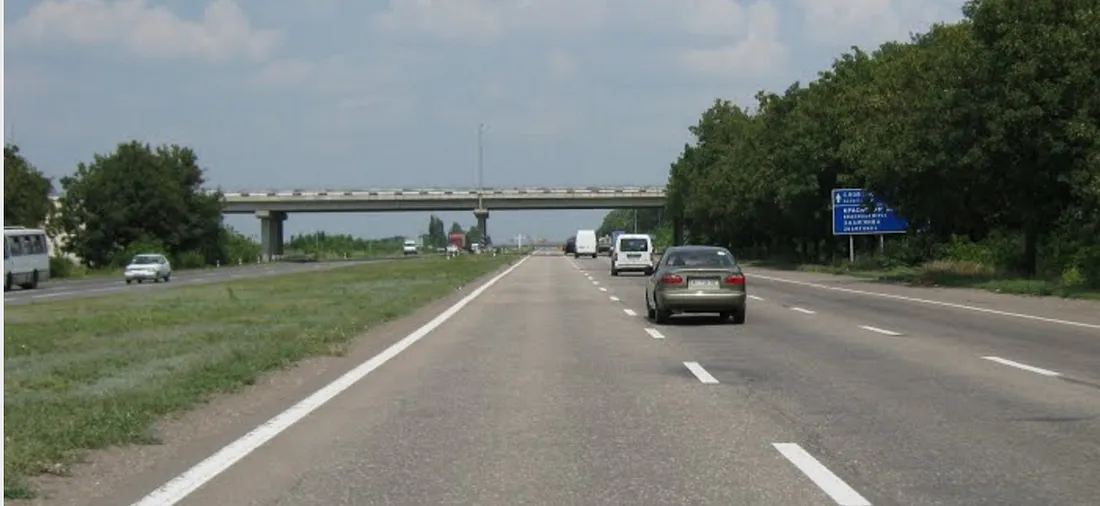
While this highway seems to be just a single-lane road, it is actually a two-lane highway with separate roads for northbound and southbound traffic. The northbound lane, to the right of the perspective in the screenshot above, has been shut down, leaving only the southbound lane to be used by both directions of traffic. Thus, the blue traffic sign on the right of the frame is quite far from the driver. A photograph on Panoramio, taken before the war, shows the highway while it was still fully functional:
The ongoing fighting north of Donetsk has become a microcosm of the current state of the Ukrainian conflict: flagrant violations of the Minsk agreements every night, but without significant territorial gains or losses by either side. However, there are still casualties and damage to property amongst the civilian populations, indicated by the reported nine houses destroyed in the outskirts of Donetsk by the Ukrainian military on November 25–26, and the destruction and injury in Avdiivka following separatist shelling in the eastern edges of the city. While the OSCE SMM to Ukraine daily reports are invaluable, there are pitfalls to solely relying on them for a full picture of the conflict situation, as there has been a disproportionate number of incidents of (mainly) separatist forces impeding monitoring efforts near their territory, as seen in their intentional shoot downs and jamming of OSCE drones and destruction of auxiliary cameras.
We will continue to monitor the progress of the implementation of the Minsk agreements, with a focus on open source evidence showing violations from both sides.