Separatist Firing Locations near Water Treatment Plant
Satellite analysis of recent fighting near Avdiivka
Separatist Firing Locations near Water Treatment Plant
Share this story

Banner: Digital Globe / NextView License
Recent fighting near Avdiivka has marked the most tumultuous period in the War in the Donbas since the February 2015 battle in Debaltseve. With satellite imagery from Digital Globe / NextView from January 20, 28, and 31, 2017, we will provide analysis of positions near separatist-held Yasynuvata and areas that were shelled, likely by the Ukrainian Armed Forces. The available satellite imagery for January 31, 2017 does not include Ukrainian positions near Avdiivka, and only includes segments of Yasynuvata, Makiivka, eastern Donetsk, and other areas to the east of government-controlled Avdiivka.
Firing locations near Yasynuvata
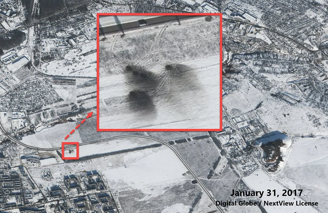
In one image, two artillery systems are visible just east of a water treatment plant between separatist-controlled Yasynuvata and Makiivka. These systems are located perilously close to a vital piece of infrastructure, endangering both the lives and water supply of local civilians. Both of these systems are pointed westward, towards government-controlled Avdiivka.
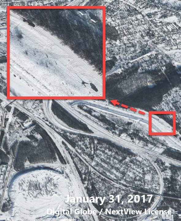
Just south of this position, almost equidistant from the water treatment, we see another separatist position with multiple truck-towed howitzers. Again, they seem to be pointing westward.
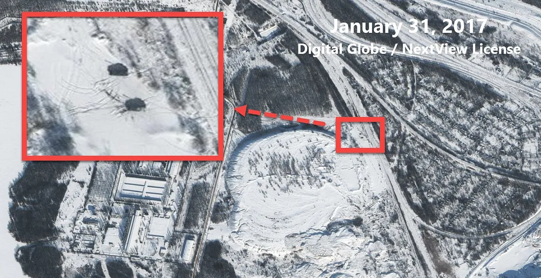
Northeast of the two previous positions, two truck-towed howitzers are visible, including one that seems to be in transport or parked while still attached to a vehicle.
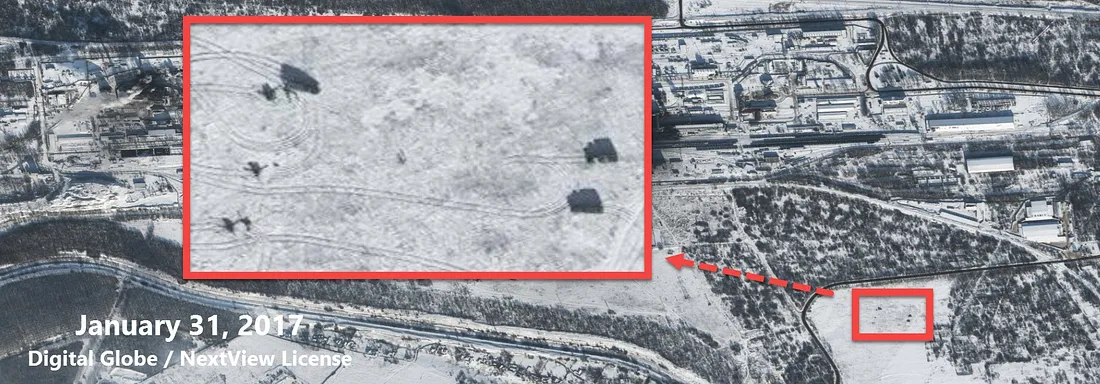
Three truck-towed howitzers and additional vehicles are visible just southeast of the Yasynuvata Coke Plant, located just west of the Gvardeysky region of northern Makiivka (separatist-controlled territory). As in the previous image, the artillery is pointed westward, towards government-controlled Avdiivka.
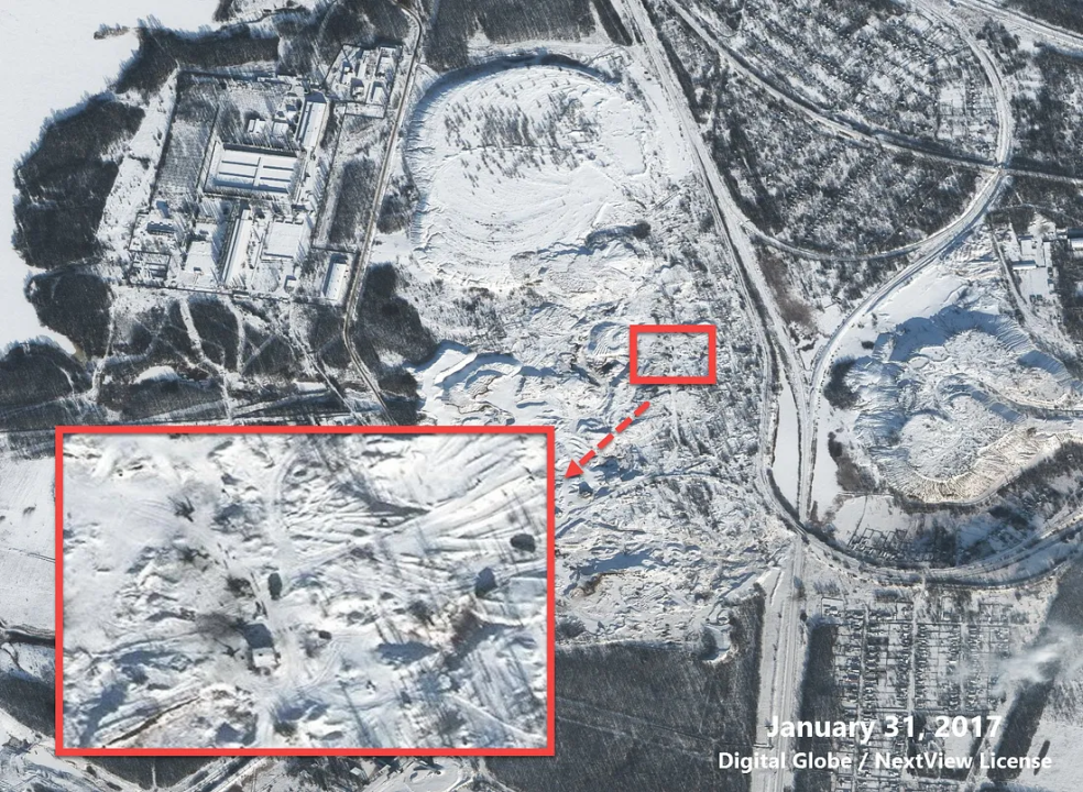
Further south from the Yasynuvata Coke Plant, two additonal firing sites are visible: one with a handful of howitzers pointing west, and another with burn marks on the ground after artillery seemingly fired westward.
While there is no artillery visible, there are clear firing locations just a few hundred meters away from a residential sector, school, church, hospital, and supermarket in eastern Donetsk. These firing locations were filmed in six videos, showing Grad rockets being launched towards Avdiivka.
Craters near Yasynuvata
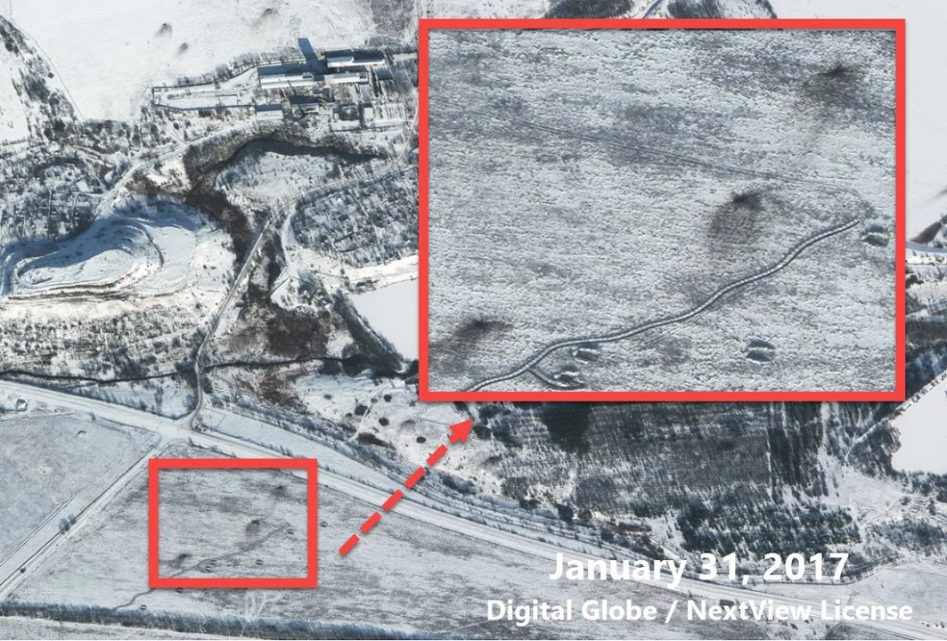
Across separatist-held territory, new craters appeared between the imagery available on January 20 and 28, 2017 and the most recent imagery of January 31, 2017.
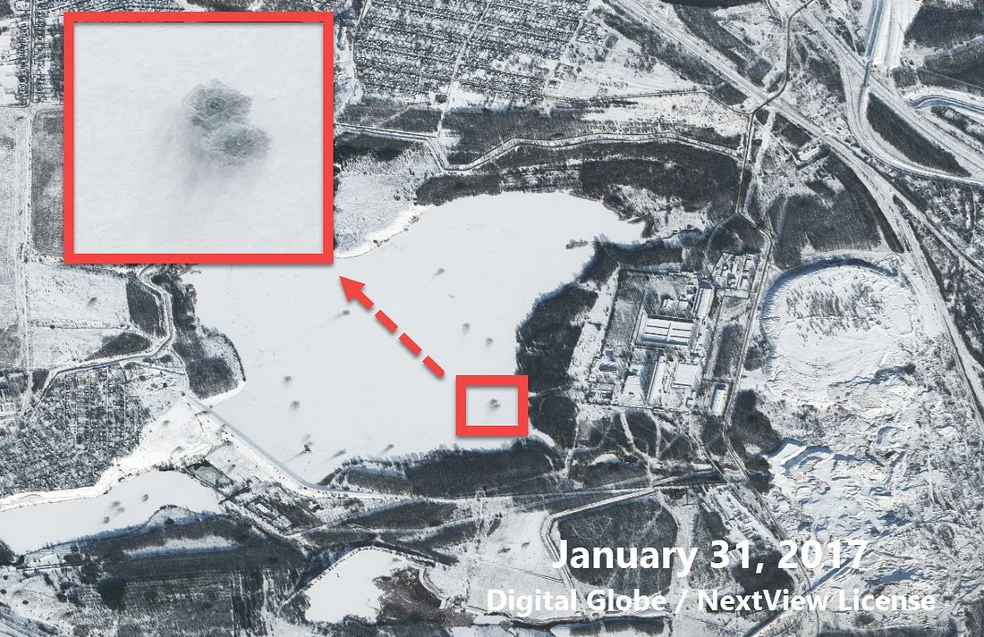
Just west of the previously discussed water treatment plant, numerous craters are visible on the frozen surface of the reservoir. These impact sites are precariously close to the water treatment plant, with separatist artillery positions on both sides of the reservoir and water treatment plant.
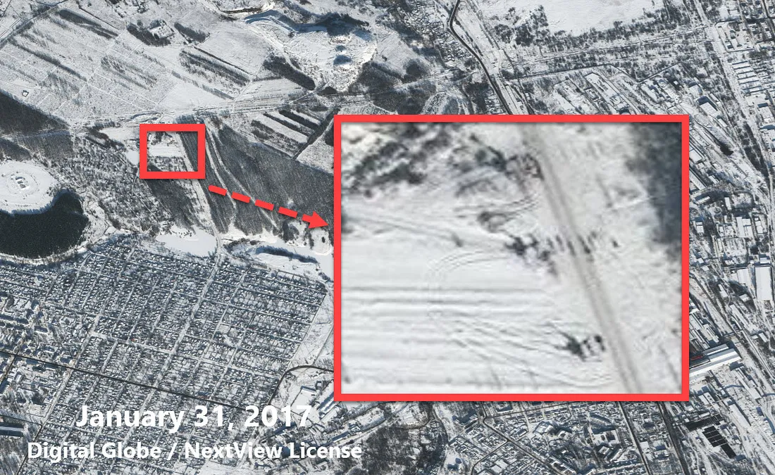
Further west of the water treatment plant, and just south of the Yasynuvata railway station, new craters appeared near entrenched positions.
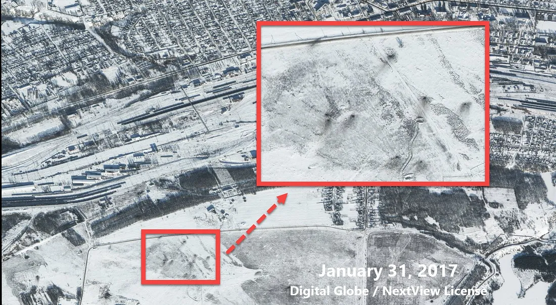
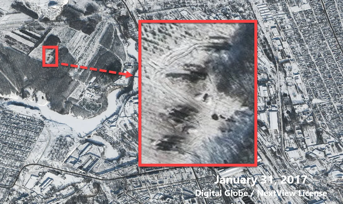
Southwest of the water treatment plant, more craters are visible next to separatist entrenchments.
Conclusion
The OSCE SMM to Ukraine likely observed several of the pieces of military equipment captured on the January 31, 2017 satellite image. In their daily report discussing observed violations for February 1, the OSCE SMM to Ukraine describes several objects that correspond with the equipment and locations observed in available satellite imagery:
In non-government-controlled areas the SMM observed: two military-type trucks, each towing an artillery piece of an unknown type, with the barrel covered, heading south towards Makiivka, and a military truck towing an artillery piece moving south near Yasynuvata. Aerial surveillance imagery available to the SMM revealed the presence on 31 January of six towed artillery pieces with their support truck and two tanks near Yasynuvata, and three towed artillery pieces near “DPR”-controlled Yakovlivka (10km north of Donetsk).
Unfortunately, there has been no satellite imagery provided by Digital Globe / NextView for January 29 onwards in government-controlled Avdiivka, making it more difficult to find both the firing locations in this territory and tanks stationed in residential areas, as discussed in this Bellingcat report. If and when satellite imagery emerges showing government-held positions after the upsurge in violence from January 29, we will publish a corresponding report on visible firing and impact sites near Avdiivka.