Escalation of Ceasefire Violations at the Donetsk Filtration Station
Explosions near critical infrastructure and the potential for a humanitarian emergency
Escalation of Ceasefire Violations at the Donetsk Filtration Station

Explosions near critical infrastructure and the potential for a humanitarian emergency

Fighting has again surged around the Donetsk Filtration Station (DFS), where military positions of Ukrainian and Russian-led separatist military positions closely surround the critical water treatment plant. @DFRLab has extensively reported on the tenuous situation surrounding this piece of critical infrastructure, which has the potential to cause a humanitarian emergency by cutting the water supply and heating to some 350,000 civilians nearby and up to 1.1 million across eastern Ukraine.
https://twitter.com/SpecRepUkraine/status/943162088180146178
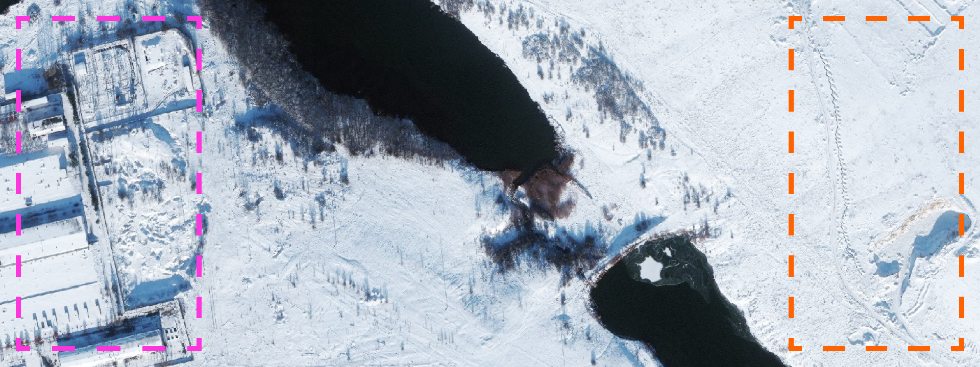
Recent satellite imagery published on Twitter by Kurt Volker, the United States Special Representative for Ukraine Negotiations, highlighted how military positions are in particularly close proximity to the DFS.


In a press statement, the U.S. Department of State emphasized the potential for a humanitarian crisis if the DFS — and the poisonous chlorine gas stores at the facility — are hit. DFS employees are currently trapped in the facility’s bomb shelter.
.@statedeptspox: The United States calls on #Russia to put an end to the attacks in eastern #Ukraine, withdraw its forces and heavy weapons from the sovereign territory of Ukraine, and agree to a robust @UNPeacekeeping mission. pic.twitter.com/V3tHVSfHar
— Department of State (@StateDept) December 19, 2017
The Organization for Security and Co-operation in Europe’s Special Monitoring Mission (OSCE SMM) to Ukraine recorded a substantial escalation of kinetic activity with approximately 100 explosions and over 300 projectiles from December 17-18 and over forty 40 explosions and 500 projectiles from December 18-19.
As @DFRLab reported last month, satellite imagery from 2016 showed extensive military positions and trenching around the DFS.

The more recent imagery released on Twitter by Volker shows one new position just 500m south of the DFS.

Conclusion
The escalation of fighting near the DFS, as well in the Svitlodarsk bulge area, is of particular concern given timing with Russia and Ukraine’s recent withdrawal from the Joint Centre for Control and Co-ordination (JCCC), a coordinating body run jointly between Russia and Ukraine to implement ceasefire and security conditions.
@DFRLab will continue to monitor the situation concerning the tenuous environment around this piece of critical infrastructure during the harsh Ukrainian winter.
Follow the latest Minsk II violations via the @DFRLab’s #MinskMonitor.
Also, follow @DFRLab on Twitter for more in-depth analysis from our #DigitalSherlocks.

