Geolocation of Ukrainian ATGM Use
How to locate where a Ukrainian paratrooper destroyed a separatist BMP
Geolocation of Ukrainian ATGM Use
Share this story
BANNER: Screenshot from a repost of video from Military TV UA (source)
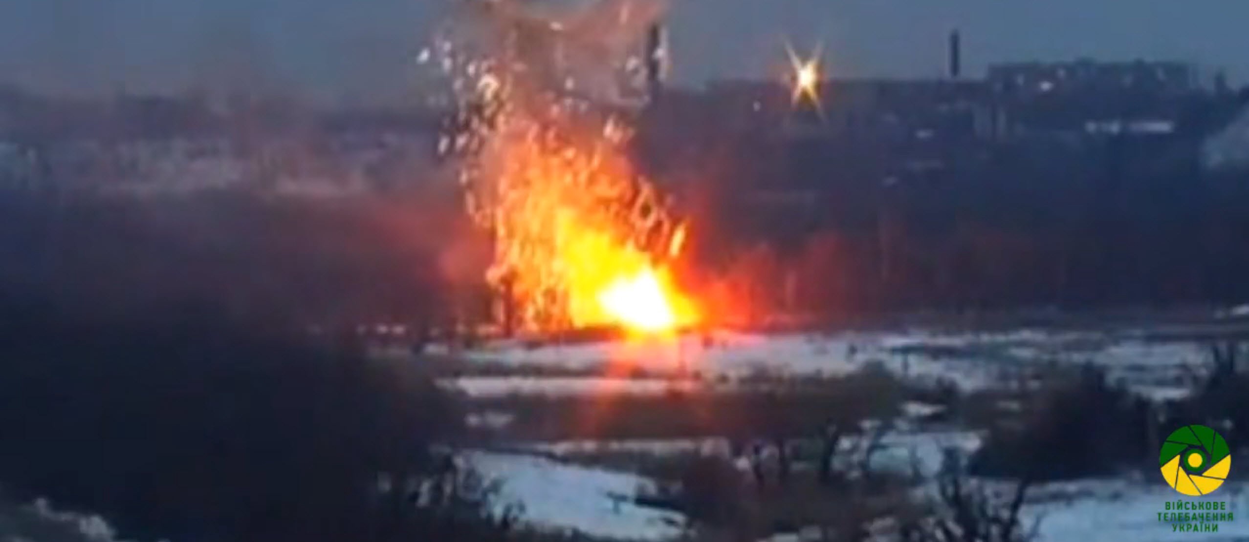
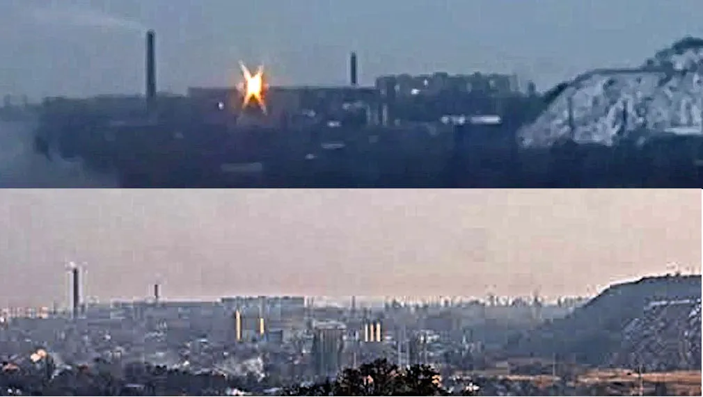
On Thursday, February 23, the Ukrainian Ministry of Defense’s television channel, Military TV UA, posted a video showing an interview with a paratrooper and footage of a BMP (armored personnel carrier) being hit by an anti-tank guided missile (ATGM) outside of Donetsk. In this video segment, the soldier being interviewed tells how he used the ATGM to destroy the Russian/separatist BMP. Since posting the segment, Military TV UA has made the video private, but it has been reposted on several other YouTube channels, preserving the footage.
Ukrainian media reportedly widely on this video segment, as video footage of ATGMs deployed in the Donbas is quite rare. However, there have not been any public efforts to verify the footage and provide an exact location for the destroyed BMP. DFRLab can provide this verification and geolocation now.
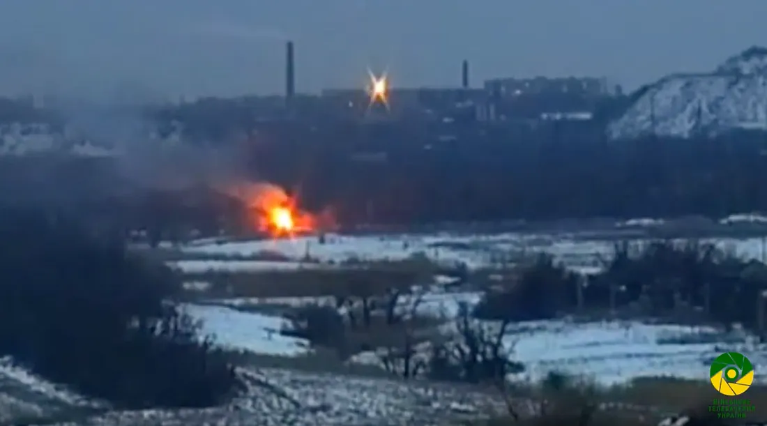
There are not many unique geographical details in the video footage, but we can discern a few elements that can drill down the exact location.
A factory in the background, with two smokestacks visible from a distance.
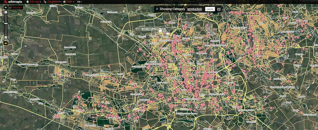
We can eliminate much of the legwork of manually searching for and identifying factories by using the Categories feature of Wikimapia. By choosing the “production” category, which includes factories, we can see the buildings labelled as such on the public database. Clearly, this doesn’t whittle down our search too much, but we can now focus on the factories on the edge of cities, more likely to be the target of a Ukrainian attack.
A hill or slagheap (террикон) in between the filming position and the factory.
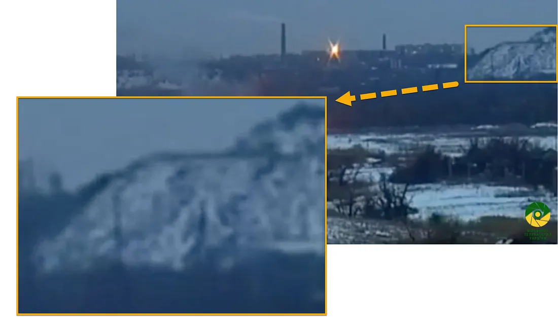
From the perspective of the camera, the hill/slagheap has a higher elevation on the right side, meaning that we should look for a slagheap that (from the camera’s perspective) rises towards the right. We can do this by adjusting the perspective and viewing the landscape in Google Earth.
Landscape and orientation
Along with these features, we can discern several elements of the landscape and orientation of the camera from the shot. For example, the camera is in an elevated position, looking down on wooded areas and a clearing. Therefore, we should look for either a tall building or another hill / slagheap in Ukrainian-controlled territory, facing the identified features.
WIth this in mind, we can cross-reference our locations with the area of Ukrainian-controlled positions. This is where LiveUAMap.com comes in, which keeps daily log of shifting positions and locations of events in the conflict.
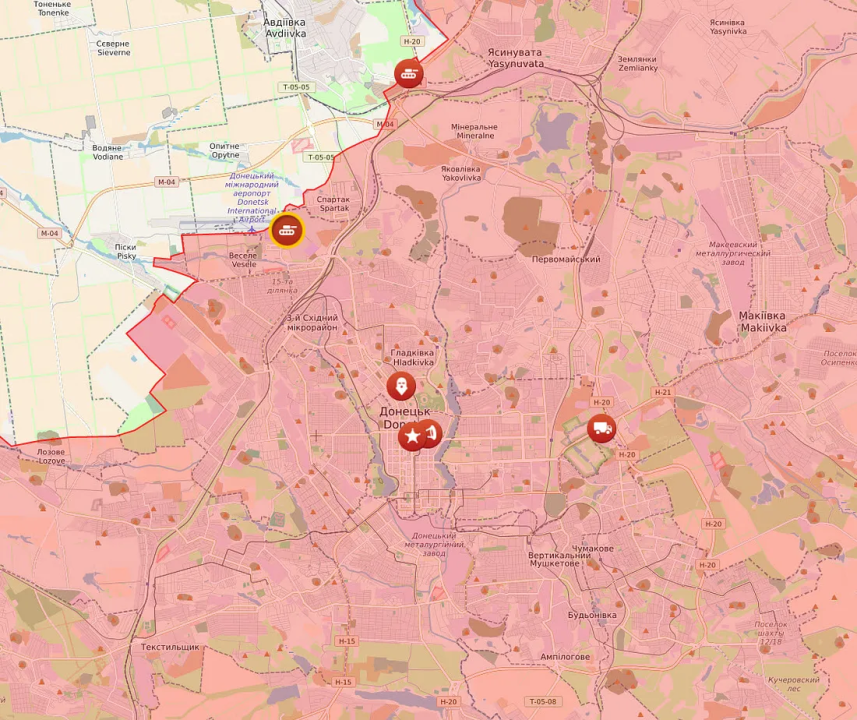
We can assume that if the attribution of “near Donetsk” is correct for the location of the ATGM hit, then it was most likely in western or northwestern Donetsk, where the Ukrainian line of control is closer to the city. While it is possible that the hit happened in southern or eastern Donetsk, this seems implausible, so it is best to concentrate near the frontline by Pisky, Opytne, and Spartak.
Putting it all together
After this analysis, we know that the video was shot in the following location:
— From a Ukrainian-controlled position, facing Donetsk
— The BMP was located near wooded area, likely near the front lines
— The video was shot near a factory with at least two smoke stacks
— The video was shot towards a hill or slagheap, with the elevation rising on the right side from the camera’s perspective
We can assume that the video was shot facing south, east, or southeast, considering the Ukrainian positions were north, northwest, and west of Donetsk. While looking through northwestern Donetsk on Wikimapia with the “production” category turned on, we can narrow down our search.
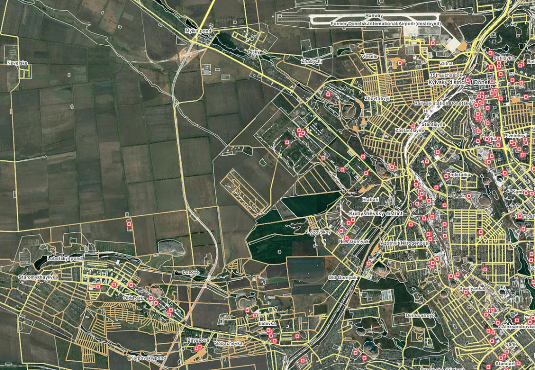
Looking for the hills and slagheaps in this area on Google Earth will even further narrow the search.
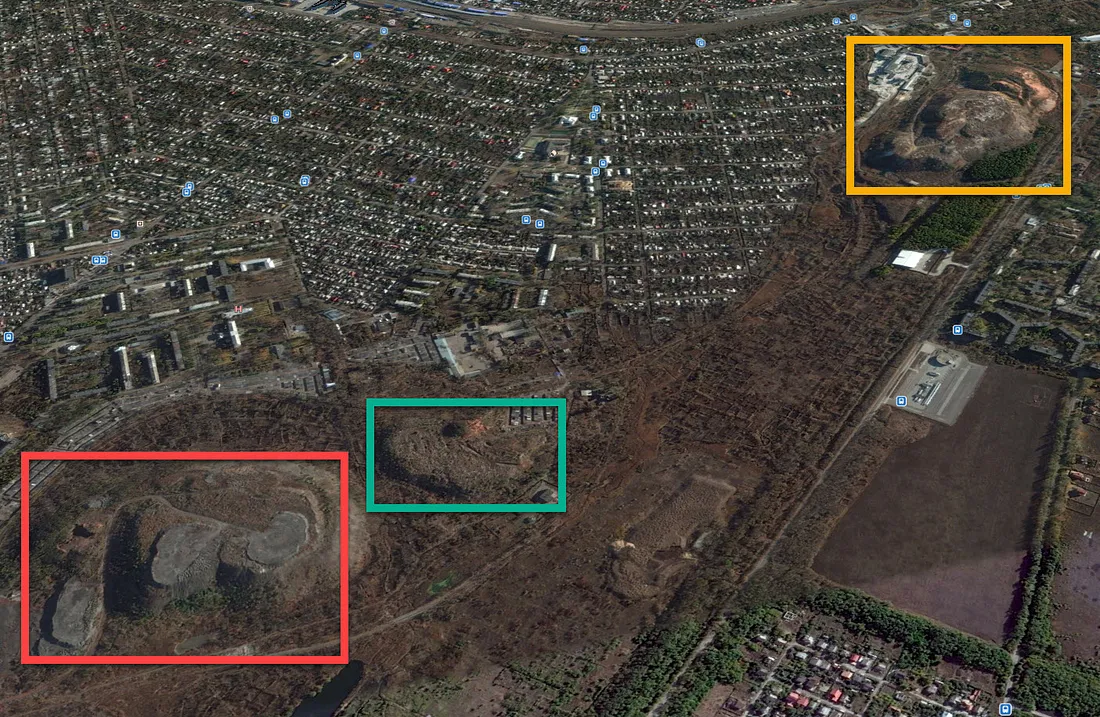
Put this all together, and we have only one real candidate that has a hill/slagheap in between the camera (from a Ukrainian-controlled positions) and a neighboring factory, along with a clearing and wooded area towards the camera. This geolocation was first discovered by the Bellingcat investigation team.
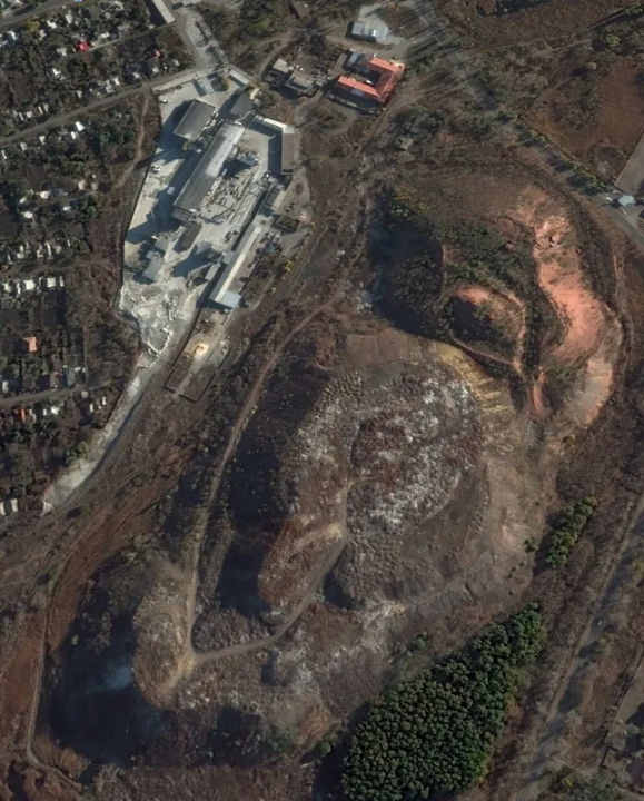
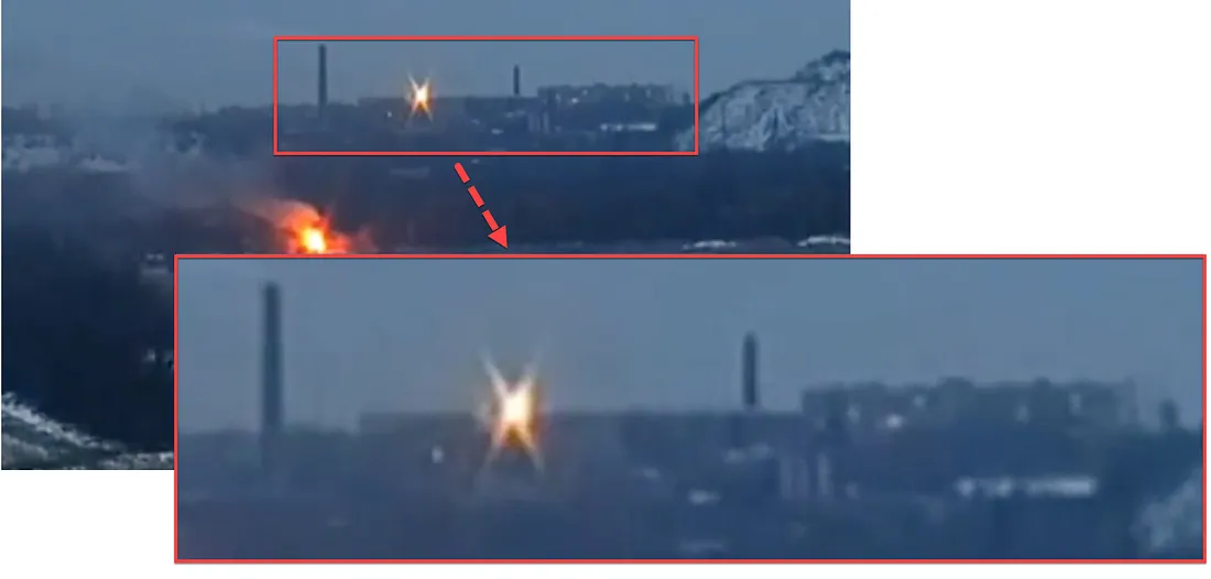
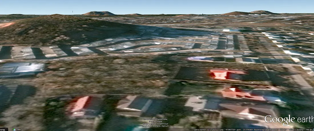
Northwest of this location is Ukrainian-controlled Pisky, and corresponding wooded areas and a clearing are in between Pisky and the factory and hill/slagheap — just as in the video. When we compare the location on Google Earth to the perspective from the video, everything falls into place: the elevation of the hill/slagheap (red arrow), the factory area (yellow arrow), and even some buildings in the distance that are barely visible in the video (green arrow).
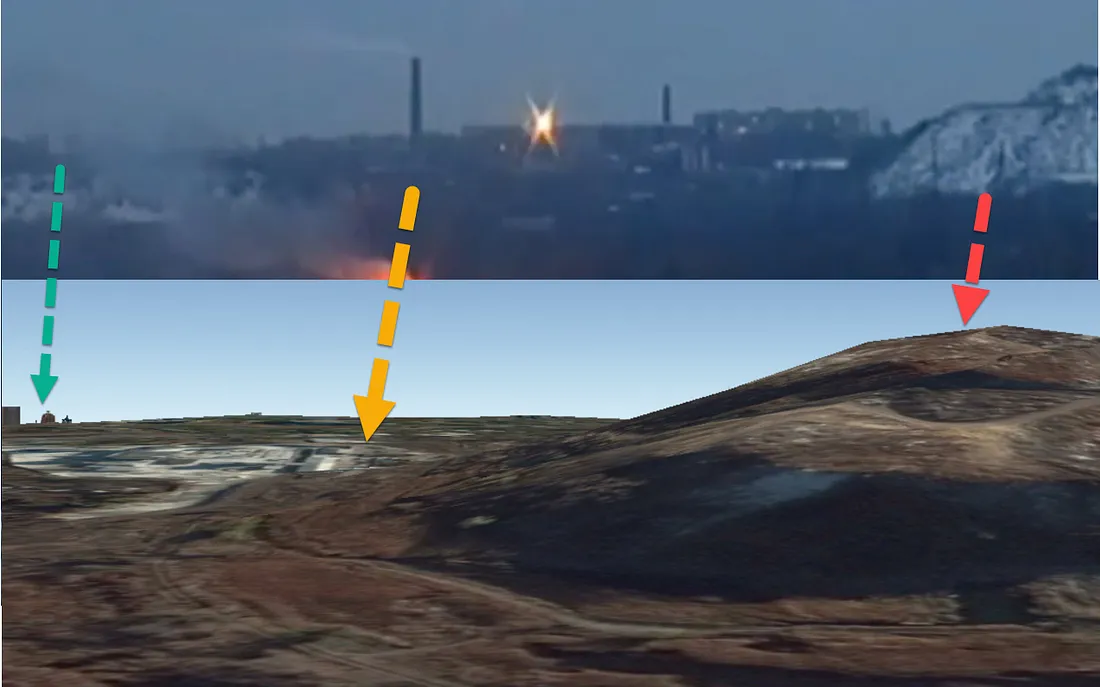
A reference image with approximately the same perspective shows that the two areas are a match. With Panoramio, a service from Google Maps that is built into Google Earth, we can find user-generated content with geotagged locations. A 2011 photograph of northwestern Donetsk shows the same factory and slagheap:
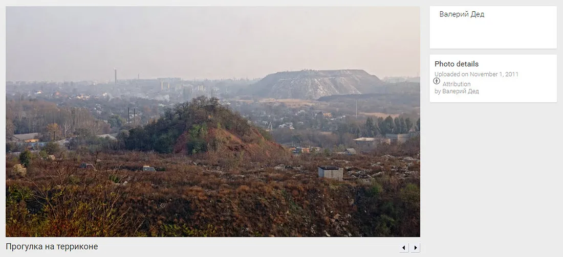
Focusing in on the factory and slagheap in the center-left part of the horizon, we can see that the features match, albeit from a slightly different perspective and distance.
However, this is not even the first time we have seen ATGM use from Pisky. An old video showing a group of Ukrainian soldiers firing an ATGM was filmed from a fortified position in Pisky.
Conclusion
In sum, we can say that the interviewed paratrooper used an ATGM to destroy a Russian/separatist BMP on the frontlines between Pisky and Donetsk, assuming that a BMP was indeed destroyed in the footage (it is difficult to tell with absolute certainty due to the low video quality). The paratrooper fired from a Ukrainian position near Pisky, and destroyed the BMP at around 48.033766, 37.724884, near the Donetsk factory “Astor” and the slag heap for Mine №10. However, to conclusively identify the destroyed object as a Russian/separatist BMP, additional video footage, satellite imagery, or ground-level photography is necessary.